http://www.nhc.noaa.gov/refresh/graphics_ep5+shtml/114641.shtml?gm_track#contents
It is a new feature off this page (click interactive map)
They keep moving the line whenever they have new info.
Just zoom in on our area and hit refresh every once in awhile.
They just changed the line from being directly over La Manzanilla to coming
ashore by Careyes.
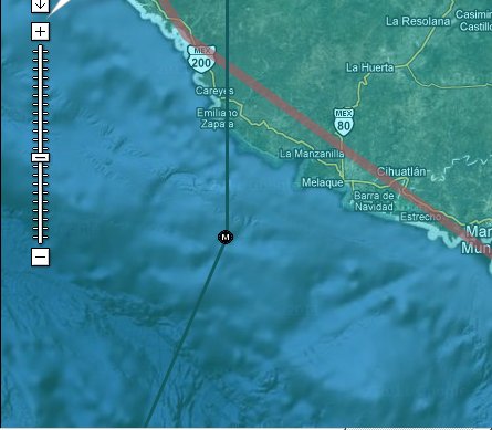
I hope it keeps changing cause if it goes ashore in Careyes we will get one
hell of a storm surge

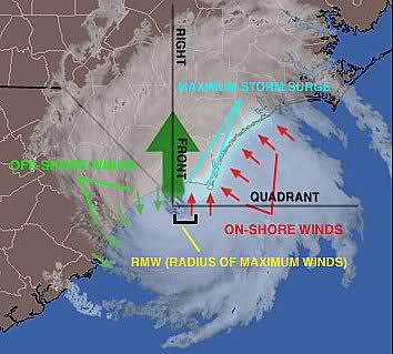
I would like to see it go ashore someplace South of us, that would give us
an off shore wind, i.e. very little to no storm surge