 on September 12, 2012, 9:12 am
187.146.105.121
Invest 90E and super cell
Posted by Bret B![]() on September 12, 2012, 9:12 am
on September 12, 2012, 9:12 am
187.146.105.121
We had hours of distant thunder starting last evening, followed by 0.44" of rain so far this morning. We were being grazed by the outer edge of a huge area of extremely heavy thunderstorms associated with Invest 90E which is about 250 miles to our south. Check out the GOES IR loop (http://www.ssd.noaa.gov/goes/west/epac/flash-avn.html) for some of the nastiest-looking convection I've ever seen in our vicinity. We were lucky we weren't directly under that super cell centered to our west. Here's a snap shot of the super cell from 0700 UTC (2AM La Manz time). FYI, La Manz is on the coast just to the right of the dashed vertical longitude line which is 105W: 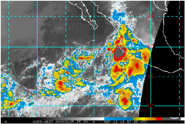 And 2 hrs later it was still going strong, but heading farther away from us: 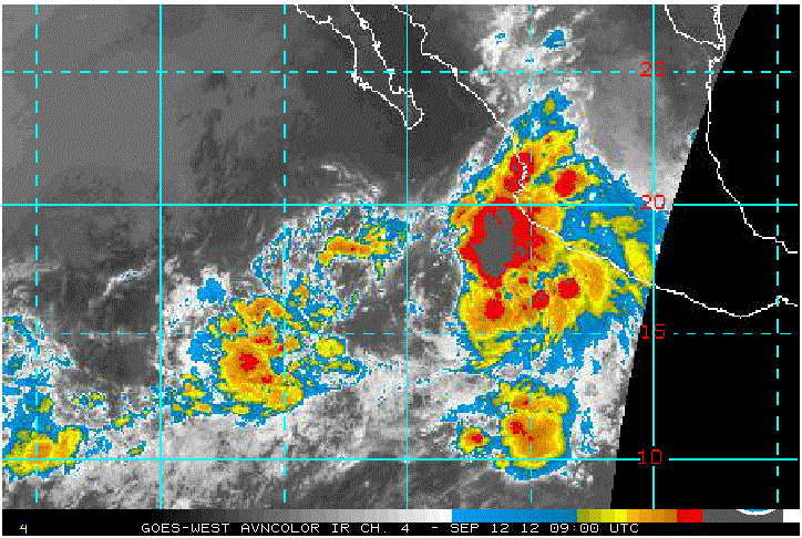 Invest 90E will become a Tropical Depression this morning probably, and mabe a Tropical Storm in the next day or two. Its center will track well offshore as it passes by us today and tomorrow, but as we've seen its clouds and rains extend out this far so we might get some more wet stuff today and maybe tomorrow. Here's the computer models of the track: 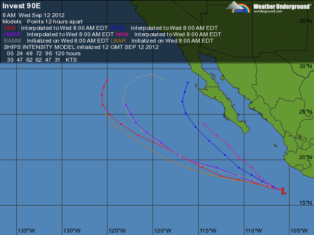 |
| 304 |
|
|
| By posting, you confirm that you have read and Back |
Be sure to visit www.lamanzanilla.info