 on June 28, 2014, 8:44 am
201.138.182.30
|
This Invest has a 60% chance of developing into a tropical cyclone in the next 2 days, and 80% in the next 5 days. ("Tropical cyclone" means either a numbered tropical depression, a named tropical storm, or a named hurricane.) The center of the Invest is well to our south, and predicted to follow the usual storm track: http://www.wunderground.com/hurricane/east-pacific/2014/invest-96E?map=model 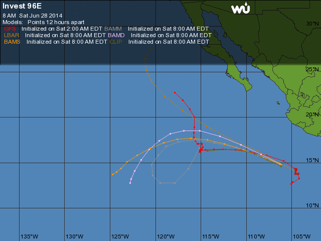 It MIGHT bring us more rain than usual for one of these routine pass-bys. One of my rain prediction computer model sites shows us getting over 250mm (12") over the next week, presumably being transported from the storm that Invest 96E becomes: http://wxmaps.org/pix/prec3.html 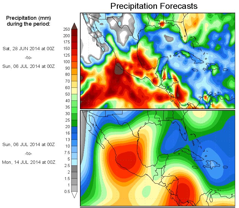 I wouldn't panic yet; this is the only one of my sites predicting this much rain. Usually most of the rain from a distant storm like this falls just offshore from us. And there's another area of interest down in the breeding grounds that might become an Invest this weekend. This morning there are blobs not too far south of us. Some chance of rain today, higher chance tonight. |
| 424 |
|
Message Thread
|
|
|