 on July 1, 2014, 8:56 am, in reply to "Re: RAIN? and TS Elida - Tropical Storm Warning"
201.138.176.170
|
Yesterday it started raining moderately around 4PM and continued past 10PM. I measured 1.52" from that, plus 0.46" earlier before dawn. 24-hr total: 1.98". Nothing in the gauge this morning since midnight. 2 reports from Melaque (Tomzap forum post: http://69.73.170.179/ph5/read.php?12,154777 you might need to log in to read it ): 4.9" and 7.5" (!) Location: Tropical Storm Elida is wandering slowly and hardly moving for the next couple days. The center is staying offshore to our south but it's close enough to bring us more rain over the next couple days at least. Rains: The NHC is forecasting 1-3" for the storm total for our coast, with isolated amounts of 5" possible. We already got 1.5-2" of this, but we should be prepared for more, possible a lot more. Luckily, so far the heaviest rains in the core of the storm have been getting blown away from us toward the SE by high altitude winds. This wind shear is the main reason this storm won't get much stronger. Winds: The chance of strong winds here in La Manz is less now: down to 10-20% chance of getting tropical storm force winds (39-73 MPH.) We are still under a Tropical Storm Warning. Surf: And of course watch for dangerous surf and currents if you go in the water. How are the waves, Daniel? NHC page for TS Elida (this shows the TS Warning extent, Wunderground doesn't): http://www.nhc.noaa.gov/refresh/graphics_ep5+shtml/113610.shtml?5-daynl?large#contents 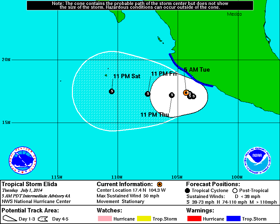 NHC Public Advisory: ( http://www.nhc.noaa.gov/text/refresh/MIATCPEP5+shtml/011135.shtml? ): "...ELIDA MEANDERING OFFSHORE OF THE SOUTHWESTERN COAST OF MEXICO WITH LITTLE CHANGE IN STRENGTH..." TS-force wind probabilities map: http://www.nhc.noaa.gov/refresh/graphics_ep5+shtml/113610.shtml?tswind120#contents 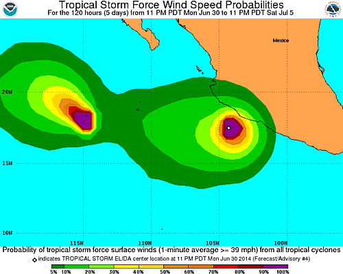 |
| 205 |
|
Message Thread
|
|
|