 on September 16, 2014, 7:19 pm, in reply to "Re: Next up: TS Polo"
201.138.178.248
|
Nothing much new in the predictions for Polo since this morning, except it is now predicted to reach Cat 1 hurricane status by Thursday morning just before it passes by us offshore a ways. http://www.wunderground.com/hurricane/east-pacific/2014/tropical-storm-Polo?map=5day 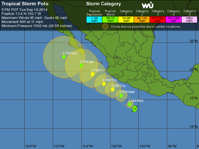 Also new, a Tropical Storm Watch has been issued for the Mexican coastline from Zihuatanejo to Cabo Corrientes (La Manzanilla is in the northern portion of the watch area.) The NHC says we have about 40% chance of getting tropical storm force winds (>39mph) at some point. These are similar numbers as those predicted for Odile. http://www.nhc.noaa.gov/refresh/graphics_ep2+shtml/233438.shtml?tswind120?large#contents 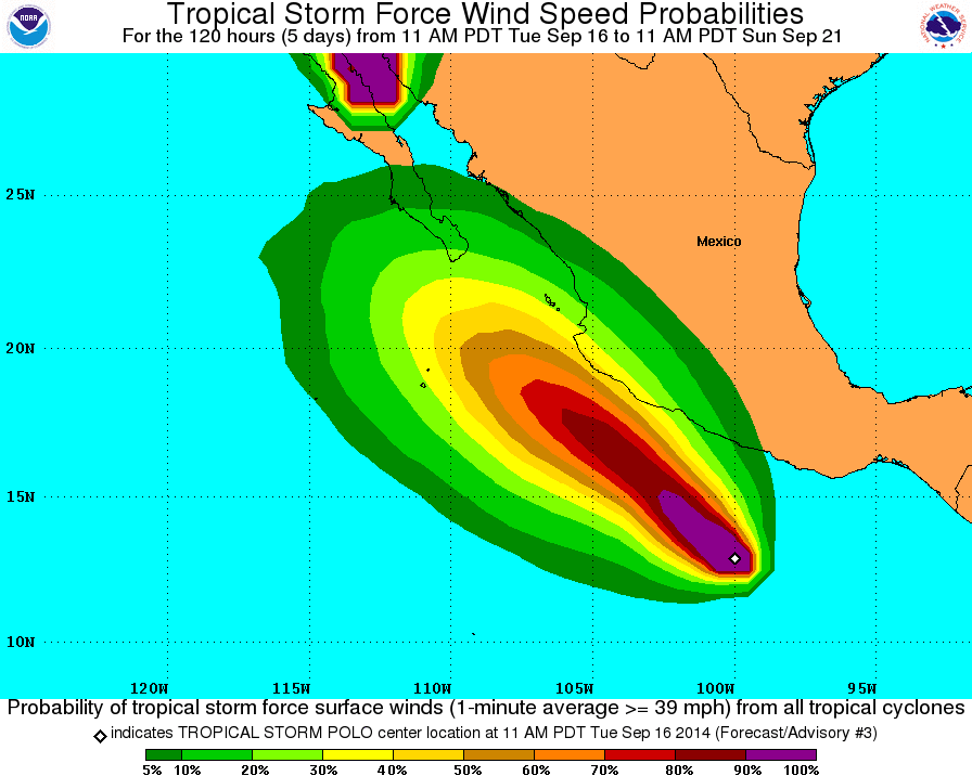 The time of closest approach looks like Thursday morning. Rains and winds could begin Wednesday evening. Jeff Masters' Weather Underground blog post for today mentions the coast near Manzanillo possibly getting 4-8 inches of rain from Polo. That would also be similar to Odile: http://www.wunderground.com/blog/JeffMasters/comment.html?entrynum=2800 "...Polo is expected to head northwest towards the Pacific coast of Mexico on Tuesday and Wednesday, and will be capable of bringing heavy rains of 4 - 8 inches of rain to the coast of Southwest Mexico near Manzanillo Wednesday through Friday...." (Note: ignore his other comments about the individual computer models. They have already changed since he made this post.) So I would prepare for another soaking rain and some more gusty breezes. Probably lower waves this time since it's not a Cat 3 hurricane. Stay tuned! |
| 217 |
|
Message Thread
|
|
|