 on September 24, 2014, 9:01 am
187.148.168.166
|
After Polo passed by we had a few days of really nice weather; sunny, breezy, much less humid than normal for September. A nice way to usher in the fall season. But the normal pattern is returning over the last couple days: hotter, more humid, thunderstorms building in the evenings. Monday evening a thunderstorm barely made it to us and gave us 0.08"/2mm, and last night we got more of one with 0.64"/16mm overnight. That was just the fringe of a HUGE (200 miles across) blob that is still travelling up the coast into Sinaloa this morning: http://www.ssd.noaa.gov/goes/west/epac/flash-avn.html The only organized tropical cyclone in the works is Invest 99E which should become at least a tropical depression in the next couple days. It's currently about 300 miles south of Manzanillo and won't get any closer to us, so I wouldn't expect much from this one. That's it for now! http://www.wunderground.com/hurricane/east-pacific/2014/invest-99E?map=model 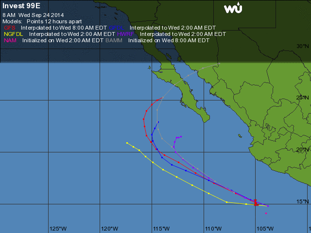 |
| 561 |
|
Message Thread
|
|
|