 on October 31, 2014, 10:21 am, in reply to "Re: TS Vance forming: rare Nov. storm"
187.148.142.164
|
The 9am CST update shows the track forecast isn't much different than yesterday. The center is predicted to pass by us offshore to the west about 200 miles away on Tuesday morning as a tropical storm, then make landfall as a depression early Wednesday around the border of Nayarit and Sinaloa. So, how wide Vance becomes will determine what rains, if any, that La Manz gets. It looks like the time window for any rains would be about Monday morning through Wednesday morning. Jeff Masters' blog has a good discussion on Vance: http://www.wunderground.com/blog/JeffMasters/comment.html?entrynum=2847 He also lists some statistics on our hurricane season so far (Vance is the 20th named storm, and there still might be one or two more to go. 2014 has been the busiest storm season since 1992!) Predicted track of the storm center. Note that La Manz is still inside the worst-case uncertainty zone (indicating that there is a REMOTE possibility that the center could hit us): http://www.wunderground.com/hurricane/eastern-pacific/2014/Tropical-Storm-Vance?map=5day 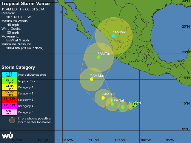 The computer models are tightening up into more agreement: http://www.wunderground.com/hurricane/eastern-pacific/2014/Tropical-Storm-Vance?map=model&MR=1 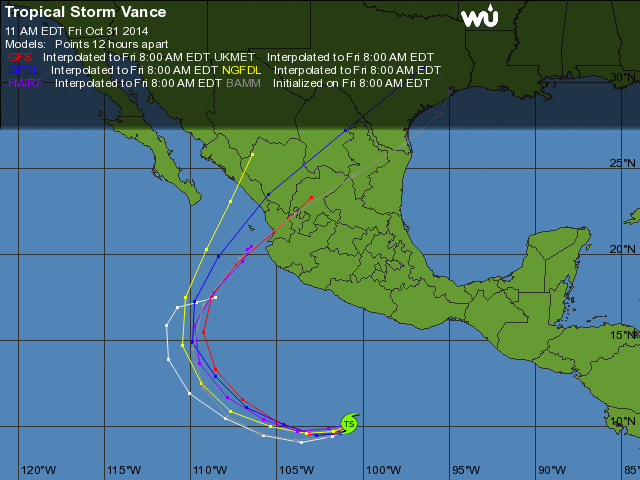 I'll post another update tomorrow AM, but I'll be going offline starting Monday AM, or possibly Sunday AM. You've got the standard links here to stay informed. |
| 176 |
|
Message Thread
|
|
|