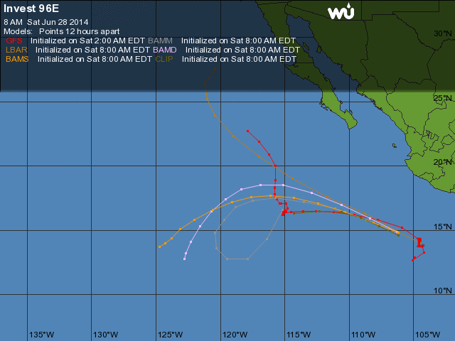
Invest 96E
Posted by Bret B  on June 28, 2014, 8:44 am on June 28, 2014, 8:44 am
201.138.182.30
This Invest has a 60% chance of developing into a tropical cyclone in the next 2 days, and 80% in the next 5 days. ("Tropical cyclone" means either a numbered tropical depression, a named tropical storm, or a named hurricane.) The center of the Invest is well to our south, and predicted to follow the usual storm track:
http://www.wunderground.com/hurricane/east-pacific/2014/invest-96E?map=model
It MIGHT bring us more rain than usual for one of these routine pass-bys. One of my rain prediction computer model sites shows us getting over 250mm (12") over the next week, presumably being transported from the storm that Invest 96E becomes:
http://wxmaps.org/pix/prec3.html
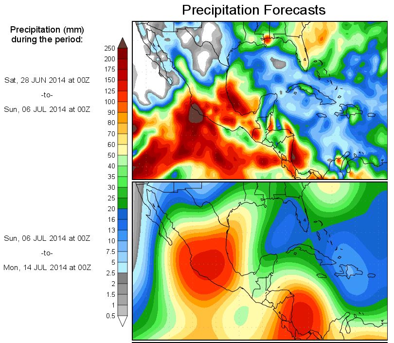
I wouldn't panic yet; this is the only one of my sites predicting this much rain. Usually most of the rain from a distant storm like this falls just offshore from us.
And there's another area of interest down in the breeding grounds that might become an Invest this weekend.
This morning there are blobs not too far south of us. Some chance of rain today, higher chance tonight.
|
-----------------------------Re: TD 4E and rain report
Posted by Bret B on June 29, 2014, 9:02 am, in reply to "Invest 96E"
187.148.170.157
So this Invest made it to Tropical Depression strength yesterday. It's supposed to strengthen into a tropical storm soon, but not much more. Still missing us by over 200 miles:
http://www.wunderground.com/hurricane/east-pacific/2014/tropical-depression-Four-e?
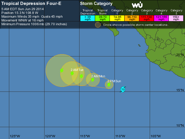
A new Invest 97E is following behind TD 4E, but is being slow to develop because of its proximity to TD 4E.
Last night's noisy thunderstorm only dropped 0.04" here at my place. Seemed like more. That rain prediction site I mentioned yesterday still shows us getting 12" over the next week. I doubt we'll get anything like that.
|
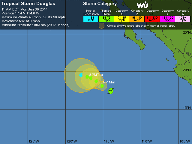
-----------------------------Re: TS Douglas
Posted by Bret B on June 30, 2014, 9:59 am, in reply to "Re: TD 4E and rain report"
201.138.176.170
This storm finally earned a name, but it's now well past us and too far to even pump any significant cloud bands our way. This is my final report on Tropical Storm Douglas. See my other post for the latest on Invest 97E.
|
-----------------------------Re: TS Douglas
Posted by Daniel Hallas on June 30, 2014, 10:17 am, in reply to "Re: TS Douglas"
187.146.129.144|
Thanks Bret, I appreciate your thoroughness in reporting the weather.
|
-----------------------------TS ELIDA
Posted by daniel c on June 30, 2014, 10:29 am, in reply to "Re: TS Douglas"
216.81.81.83|
Just got a name on the storm coming up from the south. Looks like a rian is a comin!!
|
-----------------------------
|
|
|
|
|