Posted by Bret B![]()
 on March 18, 2015, 8:08 am, in reply to "Re: Post mortem (?) storm report and new records"
187.148.43.133
A minor correction to my Top 10 list of multi-day rainfall records: the dates for Hurricane Jova were wrong. They should say 2011-10-11&12, not 2011-11-11&12.
Another interesting post-mortem graphic is the TRMM satellite's 7-day rain accumulation: http://trmm.gsfc.nasa.gov/trmm_rain/americas/americas_accumulation_zoom.gif 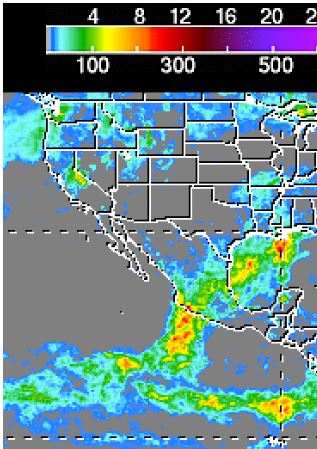
The resolution is just barely good enough to see that we had plenty of yellowish storm totals around us (about 6" / 150mm), and a few red spots not far away (about 10" / 250mm.) That's fairly good correlation with our locally-measured "ground truth."
One effect that was missing is the usual "coast effect" that I've seen in most if not all TRMM data for cyclone-related storm totals. This effect is a very noticeable decrease in the heavy rains right along the coast. The heavy rains are offshore a few dozen miles, but much less at the coast. So I learned not to extrapolate this effect to a winter storm! Here's an example from 2012-06-23: 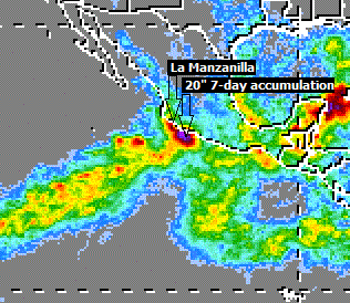
In the case of our Winter Storm #9, it was interesting to see how well the Weather Underground predicted the timing of the storm, even 8-9 days in advance. I don't know why they did so well this time. Usually the over-predict heavily for La Manz. Their predicted rainfall amounts were about 2x low, but better than mine (5-10x too low!)
I still have some learning to do...
354