 on October 30, 2014, 10:43 am
187.148.142.164
|
Just when you thought the tropical cyclone season might be over for us! The latest storm has been struggling for several days to graduate from mere Invest status. It's currently called Tropical Depression 21-E, but should strengthen into Tropical Storm Vance by tonight. It is predicted to swing wide around our area and make landfall late Tuesday up around Nayarit or Sinaloa as maybe a Category 1 hurricane. Jeff Masters' blog from this morning on the Weather Underground ( http://www.wunderground.com/blog/JeffMasters/comment.html?entrynum=2846 ) says in part "...The storm's heaviest rains will remain well offshore from Mexico over the next four days..." (or through Monday morning or so.) If it follows their forecast we won't get any strong winds and maybe little or no rain. BUT, as you can see from the size of the uncertainty circles on the forecast map (below), the center of the storm could possibly be anywhere from Manzanillo to the tip of Baja by Tuesday. The computer models are not in tight agreement yet (below.) So this is one of those late season storms that will take a right turn into the Mexican coastline because of the influence of a mid-level ridge now, and then a low pressure trough coming down from the NW early next week. The storm's path is balanced between these two steering forces, and is difficult to predict exactly. So keep an eye on this one! http://www.wunderground.com/hurricane/eastern-pacific/2014/Tropical-Depression-Twenty-one-E?map=5day&MR=1 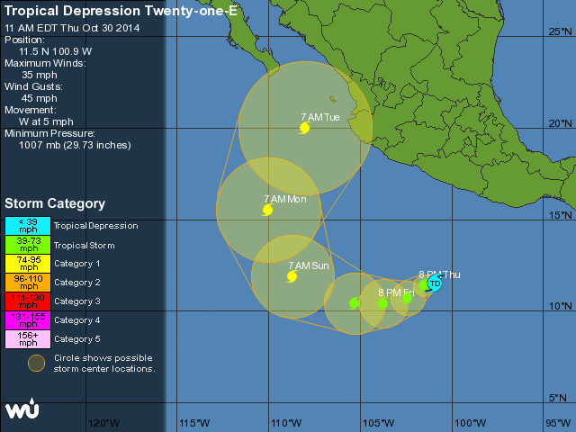 http://www.wunderground.com/hurricane/eastern-pacific/2014/Tropical-Depression-Twenty-one-E?map=model 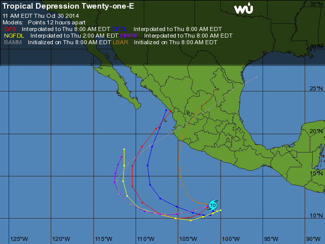 |
| 609 |
|
Message Thread
|
|
|